VOL. 3 NO. 2, 2025

ISSN 1115-2109


GNSS Anomalies: Implications for Global Airspace Safety and Efficiency
THE MEDIA FLURRY WAS INSTANTANEOUS AND INFECTIOUS, ECHOING THE SHEER GRAVITY OF THE SAFETY OCCURRENCE. THE AURA SURROUNDING THE NEWS WAS EQUALLY ALMOST PALPABLE, WITH ACCUSING FINGERS POINTING UNMISTAKABLY TOWARDS THE KREMLIN. IN THE AFTERNOON OF SUNDAY, 31ST AUGUST, 2025, AN AEROPLANE CARRYING THE PRESIDENT OF THE EUROPEAN UNION (EU), URSULA VON DER LEYEN, WAS HIT – ENROUTE PLOVDIV, BULGARIA – BY SUSPECTED RUSSIAN GPS JAMMING, WHICH DISABLED GPS NAVIGATION SERVICES AT THE BULGARIAN AIRPORT, FORCING THE AIRCRAFT’S PILOTS TO RESORT TO LANDING THE AIRCRAFT USING CONVENTIONAL PAPER MAPS.
That was the news. But, what remains to be said is that the 31 August 2025 incident underscored not only the significance of the increasing threats posed by Global Navigation Satellite System radio frequency interference (GNSS RFI) to global aviation safety but also the need to interrogate the continuing utility of conventional navigation infrastructure in a world where progressive increases in the adoption of innovative technologies are driving a paradigm shift towards a phased de-commissioning of legacy navigation systems and procedures, with implications for the retention of the Minimum Operating Networks (MONs) required for mitigating and managing GNSS vulnerabilities. It is one thing to desire a global airspace where GNSS becomes the prime option for reliable and efficient positioning, navigation and timing procedures. It is also a different ballgame to ensure the availability of fallback ground-based navigation aids (GBNA), particularly for scenarios where the integrity, availability and reliability of satellite-based positioning, navigation and timing (PNT) services become questionable due to unintentional events as well as intentional interference events from state and/or non-state actors.
“IFATSEA supports ICAO’s Resolution 41-8C, which calls for ensuring the resilience of CNS/ATM systems against GNSS interference. We also think that there is urgent need for redundant systems, including ground-based navigation aids and robust augmentation systems, to mitigate reliance on satellite signals, which is quite vulnerable,” says Frank Kofi Apeagyei, President of the International Federation of Air Traffic Safety Electronics Associations (IFATSEA). “In fact, these GNSS anomalies should be viewed as a new operational reality which requires systemic resilience, technical vigilance, and global coordination.”
GROWING THREATS TO AVIATION SAFETY
The safety occurrence of 31 August 2025 involving a high-profile diplomat underlines the sheer significance of the threats that malicious actions towards GNSS operations posed to the safety of the global airspace. It also underscores the importance of interference-free GNSS operations to flight safety.
“GPS jamming and spoofing have emerged as significant threats to global aviation safety and their implications for the airspace are increasingly concerning,” said Sam Mahlangu, IFATSEA Regional Director for Africa, in a recent interview with Air Traffic Safety Electronics International. “Given the critical role GNSS plays in everything from aviation to telecommunications and emergency services, we have seen the impact this is starting to have on the safe operation of flights.”
There is unanimity among aviation experts who spoke with Air Traffic Safety Electronics International regarding the global ramifications of GNSS utility and the cascading effects of GNSS RFI. The question, however, remains the quantum of the burden that Africa – a grossly under-monitored continent when it comes to GNSS anomalies – shares currently.
“Africa’s aviation sector is expanding rapidly, with increased reliance on satellite-based navigation systems for efficiency and safety. However, the continent’s vast and often remote airspace can make it challenging to detect and mitigate GPS interference promptly,” Mahlangu added. “While specific incidents in African airspace have been less frequently reported, the global nature of GPS signals means that disruptions elsewhere can have cascading effects. Moreover, the potential for malicious actors to exploit vulnerabilities in less monitored regions cannot be overlooked.”
“Indeed, there is a genuine and growing threat to South African airspace from Global Navigation Satellite System (GNSS) anomalies, such as jamming and spoofing. The increase of GNSS interference occurrences worldwide highlights the possible threats to aviation safety, even though specific incidents in South Africa are not frequently reported,” says Thomas Chauque, the Executive President of the South African Air Traffic Safety Electronics Personnel Association (SAATSEPA). “Even though there haven’t been any GNSS interference occurrences in South Africa that have been made public, the rise in these instances worldwide and the region’s vulnerabilities make preventative actions crucial. Important actions to protect aircraft operations in South African airspace include putting in place reliable monitoring systems, strengthening regulatory frameworks, and preserving alternate navigation capabilities.”

UNDERSTANDING GNSS
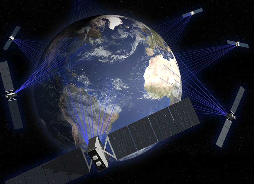
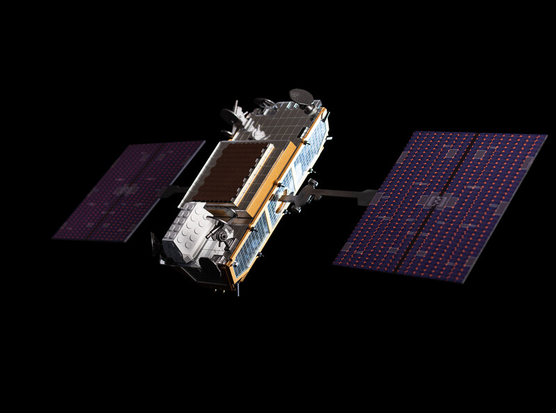
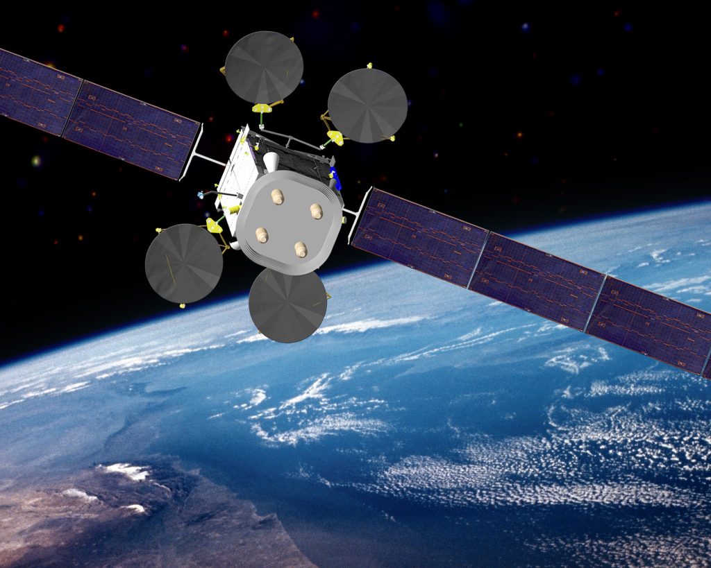
The term GNSS (Global Navigation Satellite System) integrates different satellite-based navigation systems providing PNT services worldwide. Consisting of Russia’s GLONASS, Europe’s Galileo, United States’ GPS, and China’s BeiDou – all of which transmit signals in dedicated GNSS frequency bands – GNSS integrates a ground segment including master control and monitoring stations, a space segment consisting of satellite constellations, and a user segment consisting of user terminals and application systems. The four GNSS systems feature constellations with a total of 89 satellites.
GNSS TYPOLOGIES
Quite a number of GNSS platforms have been successfully deployed in recent times. These include: Russia’s GLObal Navigation Satellite System or Globalnaya Navigazionnaya Sputnikovaya Sistema (GLONASS), China’s BeiDou Navigation Satellite System (BDS), United States’ Global Positioning System (GPS), and Europe’s Galileo Navigation Satellite System.
GLONASS – featuring a constellation of 24 satellites that operate in circular orbits with an orbital radius of 19, 140 km – is designed to provide highly accurate positioning, navigation, and timing (PNT) services worldwide. The system is designed to provide global coverage and reliable positioning and timing data aside from offering high accuracy and a high level of interoperability with the other GNSS systems. Positioned in three orbital planes, with each plane holding eight satellites, the GLONASS’ constellation of satellite operate on different frequencies.
BeiDou is designed to provide high-accuracy PNT services worldwide. The GNSS system features an orbital constellation of 35 satellites, comprising three geosynchronous satellites in inclined geosynchronous orbits, five geostationary satellites and 27 medium-earth-orbit (MEO) satellites. The BeiDou system features multi-frequency navigation signals, whilst also integrating navigation and communication, PNT, search and rescue, satellite-based augmentation and ground-based augmentation functionalities.
GPS – the most used and most popular GNSS system – currently features a constellation of 31 satellites positioned in six medium earth orbit (MEO) planes at an altitude of 20,200 km, inclined at 55 degrees to the equator. GPS is used for a wide variety of applications from space application to science applications. Aside from the traditional PNT applications serving a wide variety of users in the civil aviation, maritime and land navigation realms, GPS is also finding increasing applications for space communications, geographic information system (GIS), geodesy, photogrammetry, and autonomous spacecraft operations.
Galileo is a public, civilian-controlled GNSS system designed for the purpose of providing highly accurate and reliable global PNT services. The GNSS system – which has been operational since December 2016 – is interoperable with both GLONASS and GPS, albeit it provides better accuracy than GPS and GLONASS. Galileo currently features a constellation of 26 satellites positioned in three circular medium earth orbital planes at an altitude of 23,000 km and an inclination of 56 degrees to the equator. The system achieved aviation certification in 2023.
Aside from these big four – GPS, GLONASS, BDS, and Galileo – there are other regional navigation satellite systems. Japan’s QZSS (Quasi-Zenith Satellite System) – also known as the ‘Japanese GPS’ – is a good example. Designed essentially to be highly compatible with GPS and operating primarily in the Japanese region, the QZSS constellation boasts four satellites, comprising one geostationary satellite and three geosynchronous satellites in slightly elliptical, highly inclined orbit, with asymmetrical figure-of-eight orbital patterns.
THE FACES OF GNSS RFI
In terms of typologies, GNSS RFI is generally classified as unintentional and intentional. It is worth noting that what qualifies as an anomaly or a normal behavior with respect to GNSS signals is a function of the requirements attached to specific GNSS applications. Unintentional interference can be due to malfunctioning or incorrectly configured systems as well as unintentional interference due to terrain reflecting or refracting signals, space weather events such as solar storm, ionospheric scintillation and multipath effects. Also, because GNSS signals are extremely weak, it is possible for any equipment to unintentionally disrupt these weak signals.
Intentional interference can be due to cyber events affecting the performance of onboard avionics. However, there are two main sources of intentional interference: jamming and spoofing. Jamming involves the interruption of GNSS signals through RFI that is intentionally used to overwhelm or drown out the GNSS signals. The consequence is that the signals are overwhelmed to the extent that they are rendered unusable, resulting in a denial of service condition. Spoofing, which is rather more harmful than jamming, involves the transmission of fake GNSS signals that looks somewhat authentic. Three types of GNSS spoofing attacks have been identified in the academic literature: synchronous spoofing attack, asynchronous spoofing attack and meaconer attack. Synchronous attack, which is more complex in terms of its execution, involves the transmission of signals that are identical to the authentic GNSS signals, deceiving the receiver into transitioning to the spoofer’s signals without any disruption to signal tracking. Generally, in a synchronous attack, the power of the interfering signals is higher that the power of the GNSS signals. For an asynchronous attack, a disruption to signal tracking is necessary and the spoofer’s power should also be higher than the power of the GNSS signals. In a meaconer attack all that is required is to record and reproduce the GNSS signals.
GNSS RFI: A GROWING GLOBAL THREAT
There is no gainsaying the fact that GNSS interference events are being reported across the globe at an alarmingly increasing pace. According to IATA GNSS RFI Safety Risk Assessment (Version 4, September 2024), members of the IATA flight data exchange (FDX) program, which is based essentially on aircraft-recorded data, experienced over 580,000 instances of GPS signal loss of around 18.4 million flights processed by the FDX program from August 2021 to June 2024. The data regarding the trend of GNSS outages per 1000 flights reveal that in the first half of 2024, GPS signal losses per 1000 flights jumped to 50.8, up from the 30.8 outages per 1000 flights recorded for 2023. These figures represent significant increases when juxtaposed against the 2021 and 2022 figures of 28.1 and 30.5 loss rates per 1000 flights respectively. The IATA Safety Risk Assessment publication further made reference to EASA Safety Information Bulletin Operations’ (ATM/ANS SIB NO. 2022-02R3) observation to the effect that “GNSS RFI has become a significant safety risk, particularly in geographical areas surrounding conflict zones and the eastern Mediterranean, Middle East, Baltic Sea, and Arctic area, where RFI can increase pilots’ and air traffic controllers’ workload.”
The localization of GNSS RFI in specific geographical areas notwithstanding, it is a known fact that for a specific traffic the effects of the interference can linger even beyond the interference hotspot areas, precipitating serious degradation of navigation position integrity for the rest of the flight.
The global dimension of the prevalence of GNSS RFI events is, perhaps, no longer open to debate, although certain regions of the world need to invest greater efforts in order to develop meaningful management and mitigation strategies. “While GPS jamming and spoofing have been more prevalent in certain global hotspots, the interconnected nature of aviation systems means that no region is immune,” Mahlangu opined. “For Africa, proactive measures, technological investments, and regional cooperation are essential to safeguard its airspace against these evolving threats.”


A GLOBAL, MULTI-JURISDICTIONAL RESPONSE
Industry stakeholders agree that a global, multi-stakeholder approach is needed in order to adequately mitigate the challenges surrounding GNSS signal interference. Sam Mahlangu is of the opinion that ensuring the reliability and resilience of GNSS services is not the responsibility of either a single party or an isolated response plan.
“Yes, I fully support the growing call for a multi-stakeholder approach to mitigating the challenges surrounding GNSS signal interference,” said Mahlangu. “Collaborative efforts involving Member States, industry stakeholders, researchers, and international bodies are essential to develop robust policies, share best practices, advance technological solutions, and coordinate effective responses to both unintentional and intentional interference. A unified, cooperative strategy is the most effective way to safeguard GNSS infrastructure and maintain global trust in its integrity.”
In recent times, various interventions have been made regarding GNSS RFI by industry stakeholders at the national, sub-regional, regional, and international levels. The ICAO GNSS Manual (Doc 9849), for example, specifies a wide array of mitigation measures for GNSS RFI events. The International Air Transport Association (IATA) has also made a number of interventions recently. IATA, for example, presented a Discussion Paper (DGCA – 60/DP/04/15) at the 60th Conference of Directors General of Civil Aviation Asia Pacific Regions, which took place in Sendai, Japan from 28 July to 1 August 2025. The paper discussed the growing incidence of GNSS RFI in Asia-Pacific and the impacts on civil airspace users.
Two of the Working Papers – AN-Conf/14-WP/76 and AN-Conf/14-WP/78 – presented at the 14th ICAO Air Navigation Conference, which took place in Montreal, Canada from 26 August to 6 September 2024, also addressed different perspectives of GNSS RFI challenges. AN-Conf/14-WP/76 – jointly presented by IATA, International Business Aviation Council (IBAC), International Coordinating Council of Aerospace Industries Associations (ICCAIA), International Federation of Airline Pilots’ Associations (IFALPA), International Federation of Air Traffic Controllers’ Associations (IFATCA) and International Federation of Air Traffic Safety Electronics Associations (IFATSEA) – proposed actions for the purpose of ensuring the reduction, to the extent possible, of intentional GNSS RFI events. AN-Conf/14-WP/78 – jointly presented by IATA, International Federation of Air Traffic Controllers’ Associations (IFATCA), International Coordinating Council of Aerospace Industries Associations (ICCAIA), International Federation of Airline Pilots’ Associations (IFALPA), International Federation of Air Traffic Safety Electronics Associations (IFATSEA) and International Business Aviation Council (IBAC) – presented a revised version of IATA/IFATCA/ICCAIA position regarding GBNA and MONs, whilst proposing the pragmatic rationalization of GBNA such that regional MONs of conventional navigation aids are established by States in order to mitigate GNSS RFI risks.
MITIGATING GNSS RFI
The manifestation of GNSS RFI events comes in different forms and shapes. They can manifest in the form of spurious terrain awareness and warning system (TAWS) alerts as well as false ADS-B out position reporting. They can present significant errors in navigation positions as well as abnormal differences in Ground Speed and Airspeed. They can lead to the loss of safety-critical information, such as weather information, to the flight crew. They can also come in the form of a complete unavailability of GPS service due to a transmitter emitting signals in the GPS frequency as was the case in January 2022 around the vicinity of United States’ Denver International Airport.
Guaranteeing the continuing integrity of GNSS PNT services remains an arduous task. However, multi-stakeholder and multi-jurisdictional approaches – involving Original Equipment Manufacturers (OEMs), civil aviation authorities (CAAs), national, regional and international organizations, specialized research organizations, airline operators, and so on – are being stepped up to develop effective mitigating options to guarantee GNSS integrity on a global scale.
On the OEM front, a growing army of industry players are developing and offering innovative technologies for managing and mitigating GNSS RFI. One of these players is the Leuven Belgium-headquartered Septentrio, with its AIM+ (Advanced Interference Mitigation) solution featuring adaptive notch filtering, pulse blanking and wide band interference mitigation. GPSPATRON is another formidable player. The company specializes in the localization of the sources of GNSS RFI using its innovative Time Difference of Arrival (TDOA) solutions to measure the difference in the arrival times of a signal at multiple points, with the deployment of precise time synchronization of all signal reception points to determine the coordinates of an RFI source. GPSPATRON also showcases a GNSS interference detector, the GP-Probe, which measures the parameters of GNSS signals and sends the generated data to a web-based application, known as the GP-Cloud, for analysis.
Aireon LLC, a global space-based ADS-B service provider, is another big player, especially in the realm of identifying and mitigating intentional GPS interference worldwide using ADS-B datasets. The company currently serves over 20 air navigation service providers (ANSPs). It will be recalled that in its Industry Roundup in the 2023 October/December Edition, Air Traffic Safety Electronics International reported that South Africa’s Air Traffic and Navigation Services (ATNS) and Aireon have agreed to collaborate and advance space-based automatic dependent surveillance-broadcast products and services in Africa.
Aireon is noted in the industry for leveraging its extensive ADS-B dataset to build applications that allow for the identification and mitigation of GPS interference. Using its global independent position estimator, RefTrack, Aireon has also been providing the industry with reliable data on aircraft locations particularly in scenarios where GNSS position data are unavailable.
Research organizations are by no means left out in the race for devising techniques for mitigating GNSS RFI. The German Aerospace Center (DLR) is, unarguably, at the forefront of global GNSS RFI R&D with its GNSS signal anomaly detection techniques using differential code bias (DCB) of GPS satellites and Machine Learning algorithms. Under the European Space Agency’s (ESA) NAVISP programmes, GMV NSL Ltd has also developed the COLOSSUS (Crowd-Sourced Platform for GNSS Anomaly Identification, Isolation and Attribution Analysis) system for the identification, isolation and detection of GNSS anomalies. The system, which is essentially cloud-based, has demonstrated continuous, automatic, real-time processing and fault detection capabilities as well as generated performance reports for Galileo, GPS and GLONASS systems.
GOING FORWARD
Quite a number of management and mitigation techniques are required in order to ensure the reliability, integrity and availability of GNSS-based PNT services. The army of OEMs, particularly those specializing in onboard avionics need to invest in research and development (R&D) with a view to developing operational avionics that can deal with jamming and spoofing at the scale being experienced presently.
Although, the increasing occurrence of GNSS RFI events and its implications for safety is forcing a paradigm shift towards the development of alternate positioning, navigation, and timing (APNT) options, it seems proper to concede that implementing meaningful APNT options does not look like a viable alternative in the nearest foreseeable future. The industry, therefore, may well focus more on upgrading existing GNSS RFI mitigation and management techniques as well as addressing issues surrounding the continuing availability of fallback GBNA. ◙
All rights reserved. No part of this material or the content of this website may be reproduced or published in any form or by any means without the prior written permission of the publisher.
Contact: atsei@dextermarie.com


EUROPE: Expanding the Aviation Frontiers


All rights reserved. No part of this material or the content of this website may be reproduced or published in any form or by any means without the prior written permission of the publisher.
Contact: atsei@dextermarie.com