VOL. 3 NO. 1, 2025

JULY/SEPTEMBER

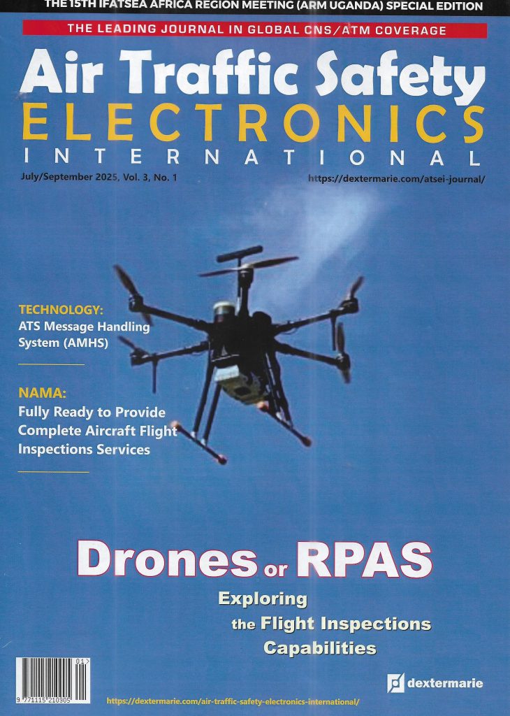
Drones or RPAS: Exploring the Flight Inspections Capabilities

THE CONDUCT OF PERIODIC GROUND AND FLIGHT CHECKS ON RADIO-BASED NAVIGATION AIDS IS A MANDATORY REGULATORY REQUIREMENT ENSHRINED IN ANNEX 10 TO THE CONVENTION ON INTERNATIONAL CIVIL AVIATION. TRADITIONALLY, THESE PERIODIC CHECKS ARE CONDUCTED USING CREWED FLIGHT INSPECTION AIRCRAFT CARRYING THE REQUIRED SYSTEMS, INCLUDING ANALYZERS OR RECEIVERS AND AN INTEGRATED AIR-TO-GROUND DATALINK SYSTEM CONNECTING THE ONBOARD SYSTEM TO A GROUND MEASUREMENT SYSTEM. HOWEVER, TECHNOLOGICAL INNOVATIONS IN THE REALM OF UNCREWED AERIAL VEHICLES ARE PUSHING THE TIME-TESTED ART OF GROUND AND FLIGHT INSPECTIONS INTO A BRAND NEW AGE.
That age is an age that will be largely characterised by the dominance of uncrewed aerial vehicles in the global flight inspections arena. It is an age that is, perhaps, better described as the Age of Unmanned Calibration Aerial Vehicles.
To say the least, drones, remotely piloted aircraft systems (RPAS), unmanned aerial systems (UAS), or unmanned aerial vehicles (UAVs) are becoming increasingly ubiquitous, opening up whole new vistas of utilities particularly for tasks and missions where precision, affordability, timeliness, accessibility, security and ease of operation are the defining attributes. Today, drone use cases that can be described as commonplace are in the areas of aerial photography and videography, traffic monitoring, disaster management, emergency medical support, search and rescue, precision agriculture, remote sensing mapping and surveying, supplies delivery, aerial photogrammetry, infrastructure inspection, security surveillance and environmental monitoring.
One other obvious area, which is just in the aviation safety, security and operational efficiency realms, is the use of drones for airport and aircraft inspections. But, debate regarding the utility of drones for aviation-related missions does not appear to be so riveted on the aircraft and airport inspection use cases as is presently the case for debates regarding drones use cases that are connected with activities in the flight inspections or air navigation systems verification realms.
DRONES IN AIRCRAFT AND AIRPORT INSPECTIONS
The use of sensors-and-cameras-equipped drones for inspecting aeronautical infrastructures in airports such as runway conditions and the structures of aircraft has become very commonplace in recent times, although the utility of drones in these terrains are largely supplementary and not intended to replace the conventional, time-consuming, often human-error prone and complex visual-inspection dependent methods. In this area of utility, drones are known for efficiency and that can’t be contested.
“Drones can bring efficiencies in conducting human-intensive activities and cover large areas in a fraction of the time, minimising aircraft downtime and increasing operational efficiency,” says Sam Mahlangu, the International Federation of Air Traffic Safety Electronics Associations (IFATSEA) Regional Director for Africa. “In the medium to long term, significant cost reduction could be realized through reduced labour hours, accelerating turnaround and circumventing prolonged grounding of aircraft.”
For aircraft inspection, drones play a key role in what is often referred to in the industry as a non-destructive testing (NDT) technique for the inspection of aircraft with a view to detecting surface and subsurface structural flaws and discontinuities. This presupposes that drones utilised for aircraft and airport inspection must carry a range of equipment such as cameras, Infrared Thermography and Laser Imaging Detection and Ranging (LiDAR).

ENTER THE FLIGHT INSPECTION DRONES
The conduct of periodic ground and flight checks on radio navigation infrastructure is a mandatory operational requirement. It is a responsibility that all Contracting States of the International Civil Aviation Organization (ICAO) incur under section 2.2.1 (Chapter 2) of ICAO Annex 10, Volume I.
Generally speaking, drones come in different forms and sometimes with varying levels of automation. There are the fixed-wing horizontal takeoff and landing (HTOL) typologies that fly just in the same manner as fixed-wing aeroplanes. There are the single-rotor VTOL (vertical takeoff and landing) and the multi-rotor VTOL variants that fly exactly like helicopters. The single-rotor VTOL aircraft are sometimes classified as helicopters while the multi-rotor variants, which are often used for aircraft and airport inspections, are called multicopters, although, in terms of speed, they are much slower than the HTOL variants. And there are also the emerging fixed-wing hybrid VTOL typologies that combine the flight capabilities of HTOL and VTOL aircraft.
Notwithstanding the form or shape a drone assumes, it must exhibit certain features and be equipped with a set of systems (both hardware and software) in other to qualify for a role in the flight inspection realms. Basically, three subsystems are essential: one, the drone system along with a payload (analyzer, console or receiver); two, a ground control subsystem; and three, a communications link connecting the ground system and the aerial vehicle along with its payload.
That said, the raging debate regarding the utility of drones for flight calibration activities has nothing to do with matters of typology. Neither is it connected with the dilemma that both air navigation service providers (ANSPs) and civil aviation regulators are currently confronted with in relation to the safe and seamless integration of the growing number of uncrewed traffic into an already crowded controlled airspace as well as the regulation of the activities of unmanned aerial vehicles. Rather, it is all about whether these uncrewed contrivances of modern technology can actually deliver cutting-edge calibration solutions to the standards specified in the relevant ICAO Annex and guidance manuals such as ICAO Annex 10, and ICAO Doc 8071 (Manual on Testing of Radio Navigation Aids) Volume I (Testing of Ground-based Radio Navigation Systems). And this is exactly where the debate actually gets trickier.
Of course, there is also the debate regarding whether drones are meant to play just a supplementary role or assume a truly mainstream functionality when it comes to ground and flight inspections. On this pedestal, Sam Mahlangu is quite upbeat about the utility of drones for flight checks. Says he: “The use of drones for conducting flight checks represents a promising and innovative shift in aviation maintenance and safety practices.”
Engr. Selzing Miri, President of Nigeria’s National Association of Air Traffic Engineers (NAAE), and General Manager, Flight Calibration Department at the Nigerian Airspace Management Agency (NAMA), Nigeria’s ANSP, is truly unequivocal about what the reality is currently. Says he: “Although a good support, a drone is actually a complementary aspect of flight calibration now. Definitely, drones cannot replace flight calibration aircraft presently, except it’s a situation where the regulations have been amended. Most regulators don’t have drone regulations. In terms of range, the capability of drones is 1 to 1.5 nautical miles (NM) on line of sight whereas flight calibration aircraft can do a range that is in excess of 20 NM. As such drones cannot perform most of the specifications in Doc 8071.”
The implication of this range limitation on the part of drones, according to Dr. Ifeanyi Frank Ogochukwu, the Managing Director of Aviation Africa Platform is that: “High-altitude or long-range checks may still require traditional platforms.”
Talking about ICAO Doc 8071, a 2018 amendment to the guidance manual actually suggests the need for an assessment of the utility and capability of drones in terms of payload, speed and range for ground and flight inspections for navigational aids.
“Doc 8071 does not capture drone activities, but only gives detailed specifications regarding what it takes during flight calibration,” Engr. Miri submits. “The Doc does not see a future where, one day, drones will be used. So, most of the specifications like measurements from 6 NM, 12 NM, 17 NM and 25 NM are specific for flight calibration aircraft. And for now, it’s known that drones cannot provide those services. But now that drones are coming, there may be amendments to regulations that will allow drones to be accepted.”
ICAO ANNEX 10, CHAPTER 2, SECTION 2.2.1
“Radio navigation aids of the types covered by the specifications in Chapter 3 and available for use by aircraft engaged in international air navigation shall be the subject of periodic ground and flight tests.”
THE PROS AND THE CONS
The traditional or conventional methods of ground and flight inspections deploy the typical crewed – usually manned by two pilots and at least one flight calibration engineer – flight inspection aircraft, which are typically multi-engine turbo-prop or jet aircraft that are fully equipped with the required equipment in terms of avionics, consoles, and receivers or analyzers. The emerging drone-based flight inspection methods, however, deploy smaller unmanned aerial vehicles, which are typically the multi-rotor variants that usually come with a composite measurement system that integrates measurement receivers, analyzers and antennas.
That said, the important question is whether the prospects and challenges attributable to each of these two flight inspection methods can be properly balanced on a fair scale of probability.
“The future of conventional flight calibration techniques, when compared to drone-enabled techniques, appears to be increasingly limited, though not obsolete in the short term,” Sam Mahlangu opines. “The conventional flight calibration is still highly accurate, well-established and certified by aviation authorities. However, focusing on accuracy and precision, drones carry sophisticated payloads, for example GNSS and LDAR, for high precision measurements, though regulatory acceptance is still catching up.”
Some experts who spoke to Air Traffic Safety Electronics International credit drone-based calibration systems with the capability to detect and measure variations in ILS (Instrument Landing System) signals in a manner unmatched by conventional measurement methods. Some experts also credit the improved measurements from drone use with the added advantage of helping to reduce the periodicity of flight inspections particularly in respect of ILS systems, which are becoming increasingly stable in terms of performance. Another plus that flight inspection experts are wont to bring out are the time-saving and cost-saving advantages of drone’s flight inspection use case. Experts also refer to other benefits, including reduction of noise pollution, reduction of CO2 emission, and reduction of airport downtime.
“For a fact, drones are increasingly being recognized as viable alternatives, or at least significant complements, to legacy flight calibration techniques,” says Dr. Ifeanyi Frank Ogochukwu, Aviation Africa Platform (AAP) Managing Director and a CNS/ATM cum cybersecurity expert. “Their use in aeronautical systems calibration, particularly for navigational aids and airport infrastructure checks, offers several advantages such as lower operational costs, improved safety, and faster deployment. Drones can executive precise, pre-programmed flight paths to collect data in a consistent and repeatable manner, which is especially useful for calibrating ground-based equipment like ILS, VOR and radar systems. In controlled scenarios, they provide sufficient accuracy to support some categories of checks without requiring full-scale aircraft.”
“When you use a drone, you are able to reduce the time that the calibration aircraft will use to check that system if the errors detected are corrected. Thus, you will save a lot of flight time and resources because globally flight calibration is charged per hour,” says Engr. Miri. “Even now, we also charge per hour. I think the last charge ASECNA billed us when we were using them was 8,500 Euros per hour. I don’t know what they charge now per hour. So, if you are able to use drone to cut off three or four flight hours, you save a lot of money. That’s one advantage of using a drone.”
And that’s as far as the prospects and pluses can go. What about the challenges?
“One major challenge that I can see for now is that most of the drones in the public domain for flight calibration do not have an alerting system that would enable the air traffic controllers to know the position of the drones and be able to effect aircraft control with reasonable separation of the drones,” opines Engr. Miri. “So, if the manufacturers of flight calibration drones can start thinking of an alerting system like ADS-B or whatever that can provide that information to the controllers when drones are being used for the calibration of navigational facilities.”
“The other challenge has to do with unmanned traffic management and aerodrome cum approach procedures. You know that our approach phases are designed for aircraft,” Engr. Miri adds. “So, when you are going to use a drone for full flight calibration, there should be aerodrome procedures that would give consideration to drone activities because most of the approach procedures we have now are for aircraft approach.”
The question of the utility of drones for either routine checks or the inspection of new navigational aids for commissioning purposes is another issue in contention when it comes to discussing the pluses and minuses of drone use cases for ground and flight inspections.
“Now, I am not too sure about the performance of drones when it comes to commissioning of a new aid because that process typically calls for a thorough check,” says Engr. Miri. “For routine checks, though, I have high ratings for drones. But, when it comes to commissioning of aids, we have to consider that the checks have to be thorough and meet all ICAO specifications. I am not too sure drones have those capabilities.”
Dr. Ogochukwu also sees quite a number of challenges confronting the use of drones for flight calibration. Says he: “While the use of drones is promising, the integration of drones into flight calibration activities faces several challenges, including regulatory constraints, technical limitations, signal fidelity and accuracy, interference and electromagnetic compatibility as well as data validation and standardization issues.”
“In relation to regulations, obtaining necessary approvals can be complex and time-consuming because aviation authorities globally are still developing frameworks that allow drones to operate in controlled airspace, especially in proximity to runways and NAVAIDS,” Dr. Ogochukwu adds. “Drone currently have payload, endurance, and range limitations compared to manned calibration aircraft. Another challenge is ensuring that drones can replicate the flight profiles and data fidelity of crewed aircraft, especially for dynamic tests like glide slope or DME signal evaluation. This is still an evolving technical area. Other two areas are the assurances that drones themselves do not introduce signal interference plus ensuring that any drone-derived data must be validated to ensure it meets ICAO and national regulatory standards.”
But, what about issues surrounding the utility of drone-based calibration reports for extending the periodicity of facilities, given the conventional practices whereby the periodicity of a facility is extended after the successful conduct of flight checks?
On the issue of periodicity extension, Engr. Miri has this to say: “For now, you cannot use drones report to extend the periodicity of your facility. After flight check, you extend the periodicity or the currency of that particular facility. If you have used drones, you don’t have the authority to use the report to extend the periodicity of your facility because such is not specified in any ICAO document now.”
GROWING ARMIES OF INDUSTRY PLAYERS
The drone flight calibration arena is blossoming by the day with an increasing number of industry players offering a wide variety of service portfolios from the provision of consoles to the provision of complete complements of the hardware and software required for meaningful drone-driven flight inspection. One of the popular and reputable original equipment manufacturers (OEMs) in the drone-enabled flight inspection arena is the Rheinmṻnster-Germany headquartered Colibrex GmbH, a leading provider of drone-based RF measurement solutions, which is famed for providing smart drone solutions for flight inspection using its UAS platforms – the COL-X8 drones.
On March 27, 2025, Colibrex, in partnership with Abuja-Nigeria based technology company, LiviaSoft Technologies Ltd, undertook a demonstration of its drone calibration system as part of a workshop tagged “One-Day Executive Workshop on NAVAID Drone: Advancement in Air Navigation and Safety”, which was organized by Nigeria’s sole ANSP, the Nigerian Airspace Management Agency (NAMA) at the Nnamdi Azikiwe International Airport, Abuja, Nigeria with the full support of the Federal Ministry of Aviation and Aerospace Development.
Colibrex’s NAVAID drone solution is unique because it is a fully integrated solution that comes with the capability of providing field measurements required for the verification of navigational aids such as the instrument landing systems (ILS), the VHF Omnidirectional Radio Range (VOR) and the Doppler VOR (DVOR). The company has obviously been making tremendous market in-roads with its COL-X8 drone-enabled calibration system. It is on record that Colibrex, in the first month of 2024, completed the delivery of a total of 11 of its NavAidDrone systems to SENEAM, the Mexican ANSP, for the inspection and maintenance of ILS and VOR systems at all Mexican airports.
Another key player in the drones-for-flight inspections field is Chelyabinsk, Russia-based company, CURSIR, which produces NAVAID calibration drones for extended ground and flight tests covering the main profiles of VOR, DVOR, ILS, RDF, MLAT, PAPI, and runway lights.
And, then, enter the Germany headquartered tests and measurements giant, Rohde and Schwarz, which manufactures and supplies a wide range of signal level and modulation analyzers that can be used as measurement drone payloads. The R&S® EVSD1000 VHF/UHF Nav/Drone Analyzer is especially famed for drone-based inspection of terrestrial navigation and ATC communications systems in the frequency range from 70 MHz to 410 MHz. The analyzer also comes with the capability to carry out accurate measurements covering VOR, ILS, DME/TACAN, GBAS and ATC communications systems at a measurement rate of 100 data records per second. Featuring an integrated air-to-ground WiFi datalink communication module and weighing just 1.5 kg, the Rohde & Schwarz’s R&S® EVSD1000 is typically suitable for use aboard medium-sized drones.
In partnership with Rohde and Schwarz, Techno Sky, a spin-off ATM infrastructure company from the Italian Civil Aviation Authority, ENAC, secured, a couple of years or so ago, ENAC approvals for the provision of drone-based ILS and VOR ground inspections at all Italian civil airports using the R&S® EVSD1000. The ENAC approvals followed the regulator’s February 2020 declaration regarding the full compatibility of the drone-based measurements carried out using the R&S® EVSD1000 at the Italian airports at Brescia Montichiari and Forti with ICAO standards.


THE FUTURE OF DRONE-BASED FLIGHT INSPECTIONS
Industry stakeholders are unanimous about the prospects of a brighter future for the large-scale use of drones for ground and flight checks.
“While drones are not yet a complete replacement for legacy flight calibration systems, they represent a transformative tool with growing utility, especially for periodic maintenance checks, system diagnostics, and hard-to-reach site assessments,” says Dr. Ogochukwu. “Over time, with continued regulatory harmonization and technological advancement, they are likely to play a central role in modern CNS/ATM infrastructure management.”
“The use of drones for flight checks is a forward-thinking solution that aligns well with the industry’s goals of enhancing safety, efficiency, and data-driven maintenance,” says Sam Mahlangu. “While there are implementation hurdles to overcome, the long-term benefits make it a compelling innovation worth adopting, with the right safeguards and training in place.”
“Conventional flight calibration techniques are likely to remain relevant for high-stakes, large-scale, or internationally regulated operations in the near term,” Sam Mahlangu adds. “However, drone-enabled calibration techniques represent the future, offering cost efficiency, flexibility, and safety, especially for localised, routine, or emerging aviation environments, for example regional airports and urban air mobility.”
Engr. Miri was especially upbeat about the salient nature of the report of the drone demonstration conducted at the Abuja airport on 27 March, 2025 involving the German company, Colibrex. “But, in fairness, I witnessed the drone calibration demonstration that was done recently in Abuja airport,” he says. “In fairness, when you look at the report from that demonstration and compare it with the results from an aircraft calibration, quite a lot of things are salient particularly in respect of the measurements done at close range. Quite a lot of things are salient, which means that drone-based calibration is actually on the right track.” ◙
All rights reserved. No part of this material or the content of this website may be reproduced or published in any form or by any means without the prior written permission of the publisher.
Contact: atsei@dextermarie.com


- FEATURES


EUROPE: Expanding the Aviation Frontiers
- INTERVIEWS


All rights reserved. No part of this material or the content of this website may be reproduced or published in any form or by any means without the prior written permission of the publisher.
Contact: atsei@dextermarie.com